Structure of the San Joaquin Valley
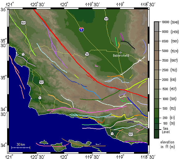
Faults and EarthquakesThe San Joaquin Valley and the mountains surrounding the valley are cut by many faults, several of which are associated with recent earthquakes. The map below shows some of the larger faults in southern California, the largest one, or course, being the famous San Andreas Fault. Faults of Southern California
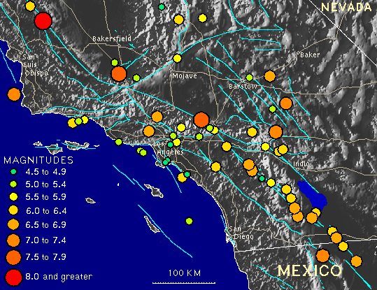
Movement along these faults has resulted in many, many earthquakes in California over the years, with the larger historic earthquakes being shown in the map below. We also have a list of some of the more important Califoria earthquakes that you can check out. Historic Earthquakes of Southern California The main earthquakes to hit the San Joaquin Valley in historic times are the Tejon Earthquake in 1857 on the San Andreas Fault and the Bakersfield Earthquake in 1952 on the White Wolf Fault. The Tejon earthquake was close in size to, and some believe larger than, the Great San Francisco earthquake of 1906, whereas the Bakersfield earthquake was the third largest quake in California after the Tejon and San Francisco events. Click the links below to learn more about these quakes.
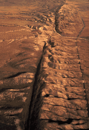
The image on the right shows the San Andreas where it cuts across the east side of the Carrizzo Plain, which is very close to the west margin of the San Joaquin Valley.
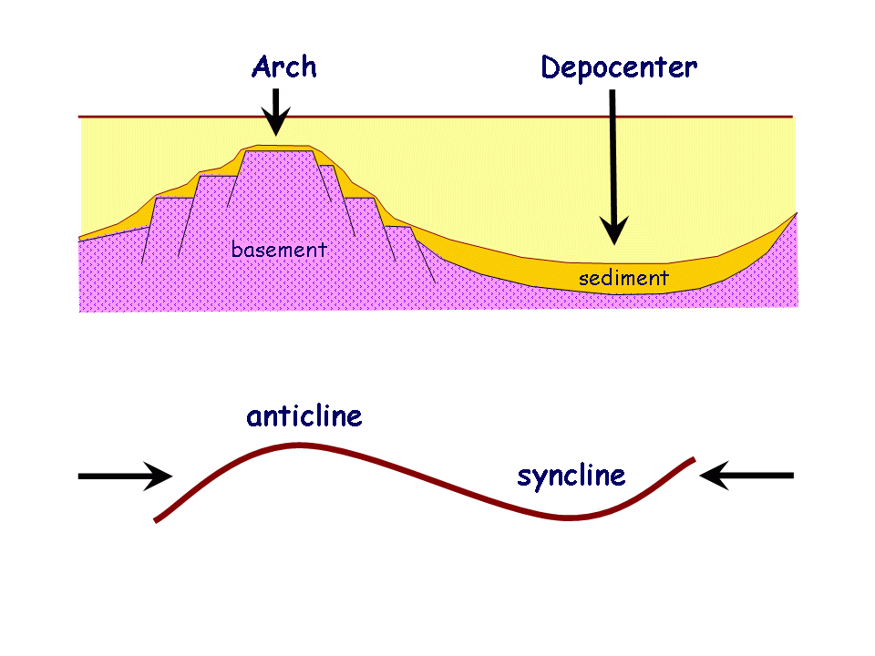
Arches and DepocentersA depocenter is that part of a basin where downwarping (i.e., subsidence) is greatest and results in a low area on the basin floor that receives the thickest accumulation (i.e., deposition) of sediment fill. By contrast, an arch develops where subsidence is minimal and results in development of a basement high, often fault-bounded, as depocenters drop down on either side of the high.
Arches and depocenters are similar to anticlines and synclines. However, an important distinction is that arches and depocenters develop from downward-directed forces (i.e., subsidence), whereas anticlines and synclines are folds that result from horizontal forces. The above diagrams show the relationships.
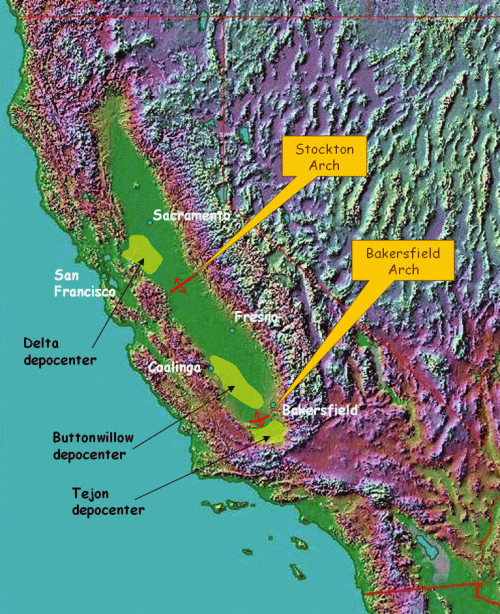
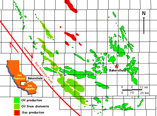
The arches and depocenters of the San Joaquin Valley (shown on the map above) are subsurface regional features that have no surface expression. Thus, they are hidden beneath the fill of the valley floor. However, there are clues to reveal their presence. For example, one can discern a NE-SW trending concentration of oil fields on the map below, just to the north and west of Bakersfield. This group of fields actually sits along the crest of the Bakersfield Arch.
What happened is that oil was generated in the depocenters (in this case the Tejon and Buttonwillow), and after being expelled from the source rocks the oil migrated into oil fields on the Bakersfield Arch. Thus, the Bakersfield Arch, and the Stockton Arch to the north are important features in the petroleum geology of the Valley.
TectonicsThe earth's crust is divided into giant plates that move across the surface of the earth to create the continents and ocean basins. Tectonics refers in part to the forces responsible for moving these plates, but it also refers to the strain that results when plates collide and slide past each other. As such, tectonics represents the driving forces responsible for creating folds and faults, as well the arches and depocenters that characterize the San Joaquin Valley. Please click here to learn more about these tectonic forces.
|
|
 TRY THESE LINKS ALSO FOR MORE INFO